Hoedspruit Economic Landscape: The Safari and Citrus Nexus
Hoedspruit is a high-growth economic node situated at the foot of the Klein Drakensberg escarpment. In 2026, the town’s economy is defined by its dual role as a global safari gateway and a powerhouse of export agriculture. It serves as the logistics hub for the surrounding citrus, mango, and avocado farms, which contribute significantly to South Africa's sub-tropical fruit exports.
The local business environment has seen a significant shift toward "lifestyle commerce." With the rise of high-end bush-aero estates and secure nature reserves, the town has attracted a wealthy residential population. This has spurred a robust secondary economy in professional services, including bespoke architecture, private aviation, and specialized security. In early 2026, the Hoedspruit Chamber of Commerce has been actively promoting a "Buy Local" initiative to integrate the town's rapid commercial expansion with small-scale artisanal producers and community-led tourism ventures.
Wildlife, Conservation, and the Canyon Gateway
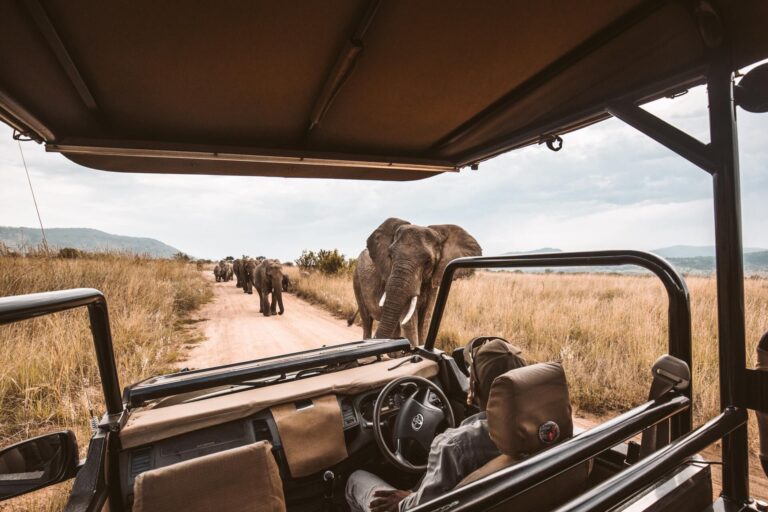
Hoedspruit is often called the "Safari Capital" of the Lowveld. It is flanked by the Kruger National Park (via the Orpen and Phalaborwa gates) and numerous world-renowned private reserves such as Timbavati and Klaserie. The town is a global centre for wildlife conservation, housing the Hoedspruit Endangered Species Centre (HESC) and the Moholoholo Wildlife Rehabilitation Centre.
Beyond the Big Five, the town is the gateway to the Blyde River Canyon, one of the largest "green" canyons on Earth. In April 2026, a significant milestone was reached with the launch of the Finale Eco-Tourism Office and a new series of community-managed hiking trails along the Olifants River. This initiative, developed under the Kruger to Canyons Biosphere Reserve, aims to create sustainable livelihoods for local communities while offering visitors an authentic, off-the-beaten-track mountain and river experience.
History: The Legend of Hat Creek
The name "Hoedspruit" translates from Afrikaans as "Hat Creek." According to local legend, the town’s name originated in 1848 when a young farmer named Dawid Johannes Joubert lost his hat in the flooded Zandspruit river during a heavy storm. The original farm was registered on 5 May 1848, marking the formal beginning of the settlement's recorded history.
Long before colonial settlement, the area was the ancestral home of the MaPulana people. The highest peak overlooking the town, Mariepskop, is named after the legendary MaPulana chief, Maripe Mashile, who led his people in defending the mountain against invaders in the 19th century. This rich cultural tapestry continues to be a point of pride, with cultural villages like Nyani providing immersive educational experiences that highlight the history of the Lowveld tribes.
Infrastructure and 2026 Connectivity
Hoedspruit occupies a strategic position on the R40 provincial road, linking it to Phalaborwa in the north and White River/Nelspruit in the south. It is one of the few towns in South Africa with its own dedicated airforce base that also operates as a commercial hub, Eastgate Airport, which facilitates several daily flights to Johannesburg and Cape Town.
Key infrastructure highlights for 2026 include:
-
Flood Recovery & Resilience: Following severe weather events in early January 2026, the Maruleng Municipality received a dedicated share of the Provincial Disaster Management Contingency Reserve Fund to rebuild rural access roads and stabilize bridge infrastructure.
-
Digital Infrastructure: The 2026 expansion of high-speed fiber across the town’s main residential estates has solidified Hoedspruit's reputation as a premier "Zoom Town," attracting a growing community of digital nomads and remote-working professionals.
-
Sustainable Energy: Several new commercial developments in 2026 have integrated large-scale solar arrays, reducing the town’s reliance on the national grid and supporting the local agricultural sector’s cold-storage requirements.